Climbing a 3,000m level mountain can be easier than you think, even for those who never hit the gym! Here is our guide to climb the peak of Mt. Norikura as a daytrip.
Summary
- 1. The easiest 3,000m mountain to climb
- 2. Basic Info
- 3. Hiking route (with map)
- 3.1. Before starting hiking
- 3.2. Start from Tatamidaira
- 3.3. Take a break at Katanokoya Hut
- 3.4. Heading to Mt. Kengamine
- 3.5. Drop by Mt. Fujimi and Mt. Daikoku (optional)
- 4. Tatamidaira area (bus terminal, restaurants, and toilets)
- 5. Some useful Japanese words
- 6. Getting to Mt. Norikura
- 6.1. No private car policy
- 6.2. Road closed during wintertime
- 6.3. From Nagano side (Bus company: ALPICO)
- 6.4. From Gifu side (Bus company: Nouhi Bus)
- 7. Recommended bus passes
- 7.1. Alps Crossing Ticket (Norikura-type)
- 7.2. 2-Day Free Passport
- 7.3. 4-Day Alps WIDE Free Passport
- 8. Recommended Tours to Norikura
The easiest 3,000m mountain to climb
Mt. Norikura (or Norikuradake) is the collective name for the 23 mountains on the southern edge of the Northern Japan Alps, with its highest peak being Mt. Kengamine (3,026m). Among the peaks on the Japanese Alps, there are 20 mountains with an altitude of more than 3,000 meters. Those peaks all require certain hiking experience, equipment and physical strength to conquer.
However, the peak of Mt. Norikura, Mt. Kengamine, is well-known for being a 3,000m-level mountain that is easy to climb, even for elementary schoolers. The reason is that the trailhead is located at the altitude of 2,702 meters and accessible by public bus, making it much easier and shorter to climb.
Basic Info
Distance: approx. 5.55 km
Time required: approx. 3 hrs. (Photo taking time is not included.)
Elevation: From Tatamidaira Bus Terminal (2,702m) to Mt. Norikura (Kengamine) (3,026m)
Hiking season: July – October
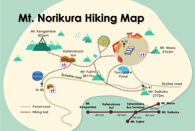
Route: Tatamidaira Bus Terminal > Katanokoya Hut > Mt. Kengamine > Tatamidaira Bus Terminal
Hiking route (with map)
Before starting hiking
Before starting off, be sure to submit your trekking itinerary plan to the mailbox at the trailhead. It is mandatory. In case of an unprecedented situation, this information will be helpful for the rescue team. Also, please don’t forget to bring a bear bell with you. If you don’t have any, you can buy one from a souvenir shop.
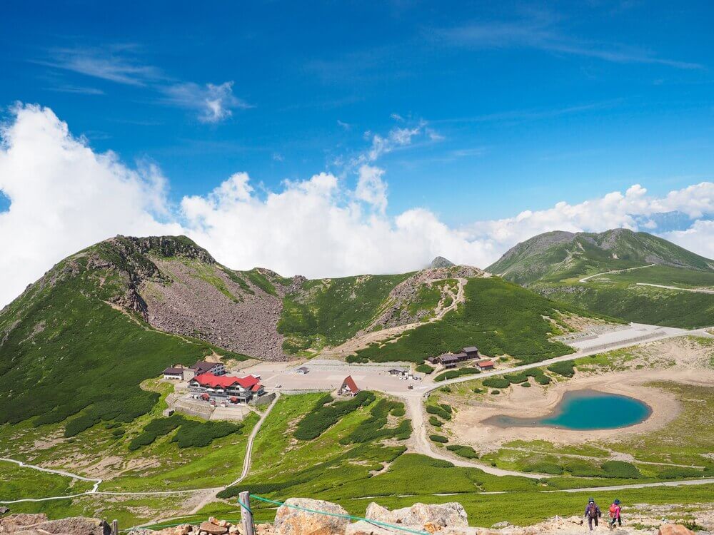
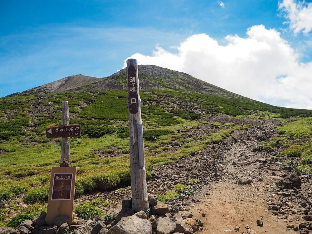
Start from Tatamidaira
From the bus terminal, look for the stairs that lead you to the flower garden below. Follow the trail until you find the strikingly beautiful Kiezuga-ike Pond on the right, walk past the pond and you will see the trailhead to Mt. Fujimi appear on your left. Keep walking along the gravel path and you will find the Katanokoya Hut. It takes about 40 minutes from the bus terminal up until this point.


Take a break at Katanokoya Hut
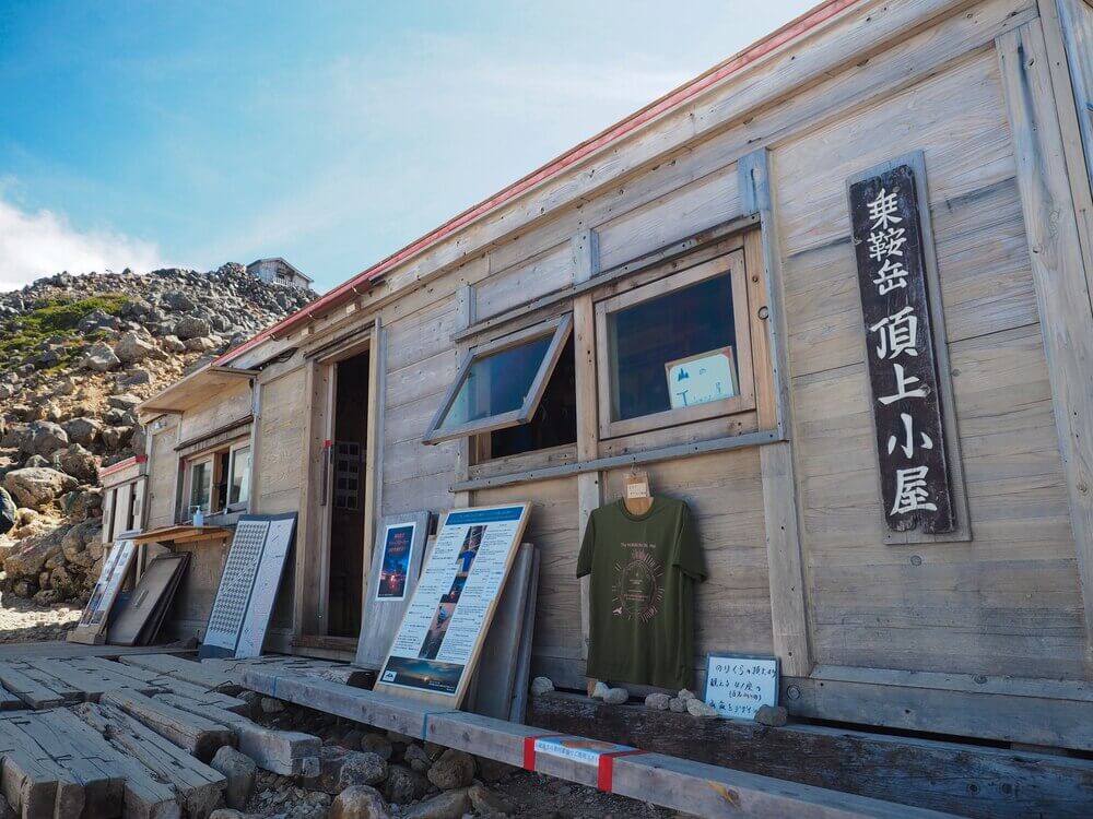
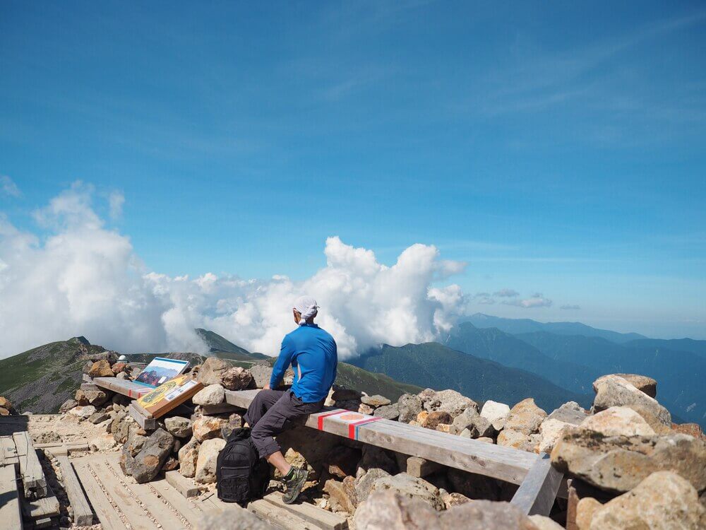
Here at Katanokoya Hut, they have simple lunch menus such as curry rice, soba noodle, udon noodle, cold beverages and soft serve. We usually save it for the descending trip. The soft serve is even better after having conquered the peak. Those with weak knees can rent a pair of trekking poles for 300 yen. (1,000 yen for deposit is required.)
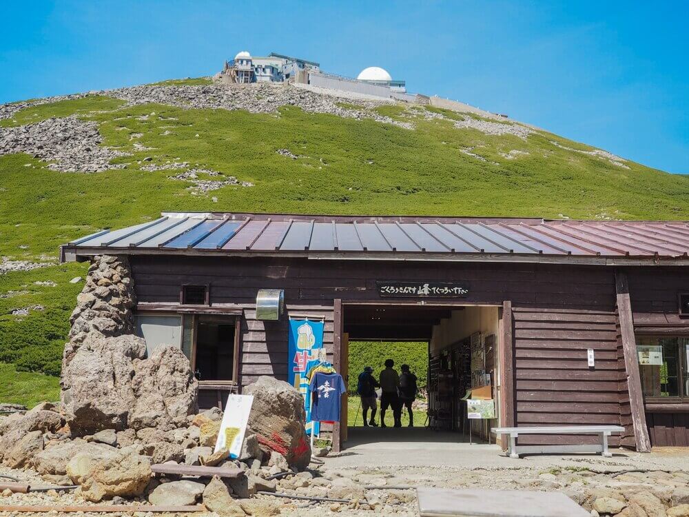
The Katanokoya Hut is located halfway to Mt. Kengamine, selling mountain climbing related gifts, as well as offering hot meals, cold beverages and snacks.

The Katanokoya Hut is located halfway to Mt. Kengamine, selling mountain climbing related gifts, as well as offering hot meals, cold beverages and snacks.
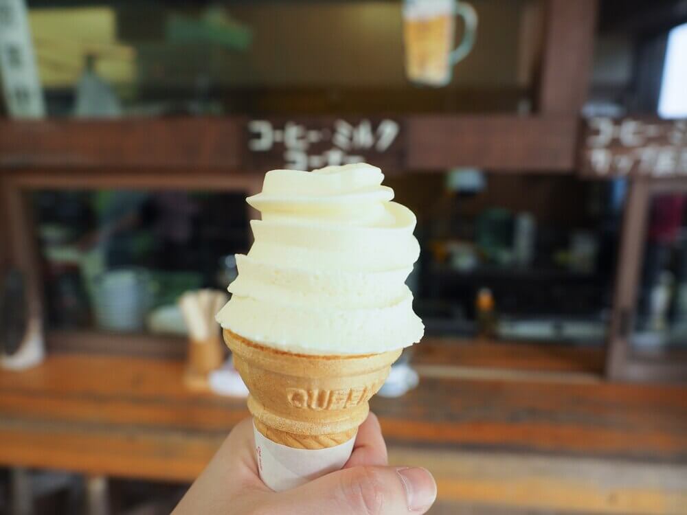
Creamy and sweet soft serve! Honestly, this would get a 10 out of 10 if it came with a sugar or waffle cone.
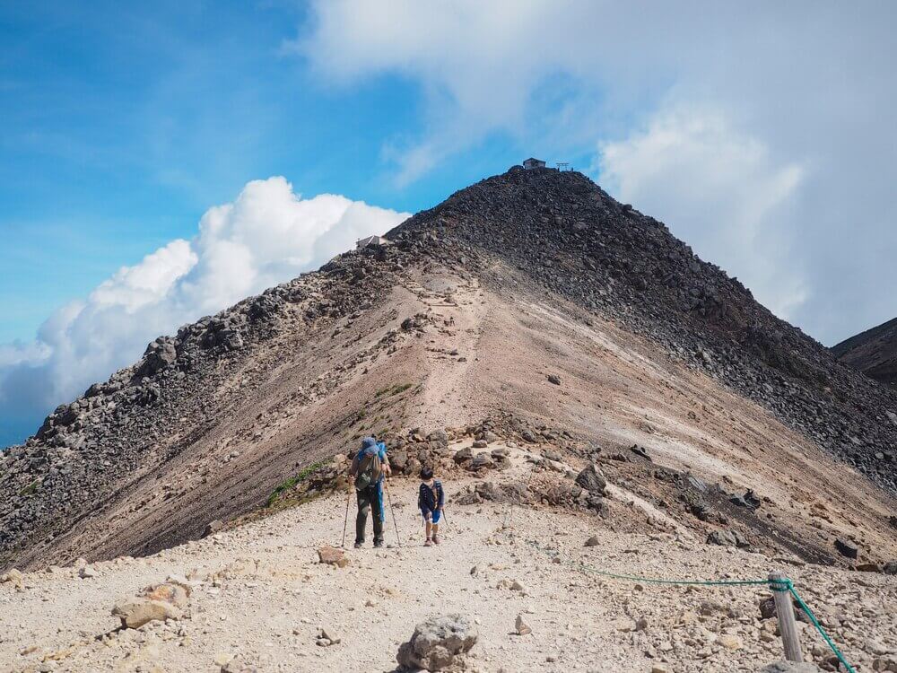
Heading to Mt. Kengamine
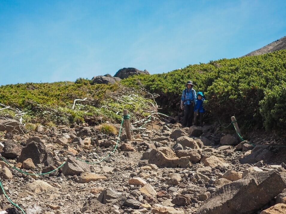
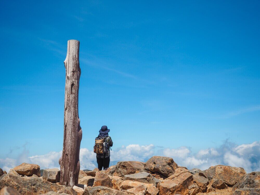
The real hike starts from here. The beginning is the hardest part as the trail is mixed with sand and small stones, making it very slippery.
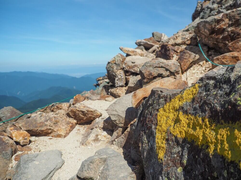
The next section is the rocky area where you sometimes need to use your hands for balance. Gloves are not necessary but it’s better than wearing nothing. Keep an eye out for arrows and circles on the rocks for the right direction.
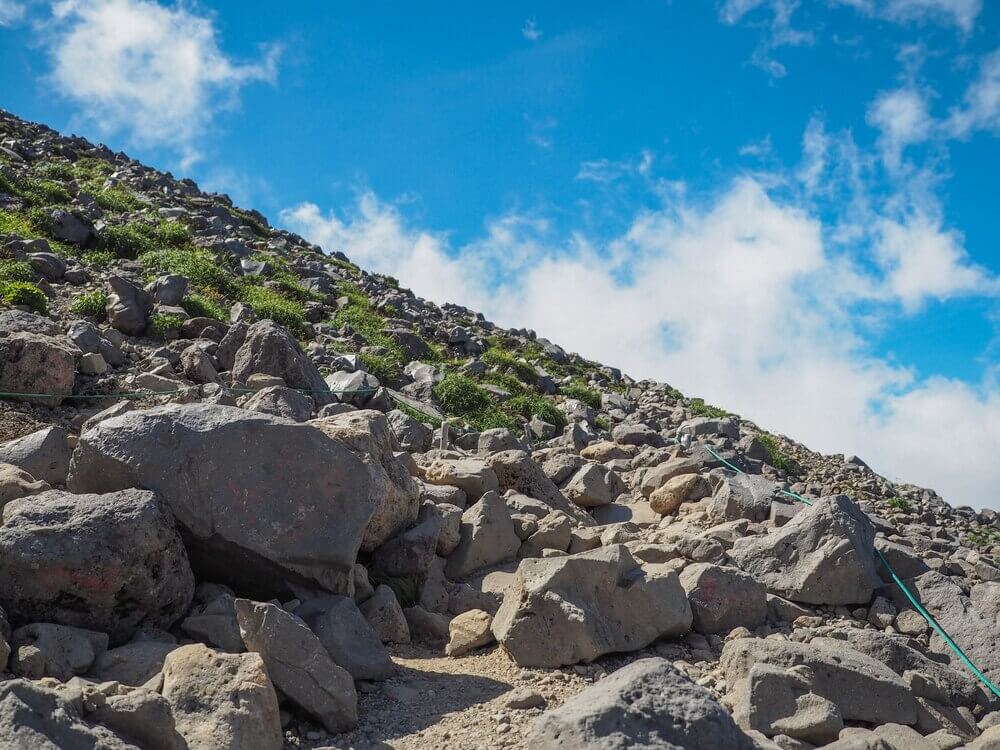


The left side is for climbing up and the right side is for descending.
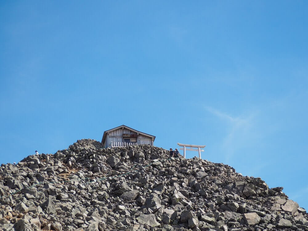
Zoom in. There it is! The highest peak of Mt. Norikura.
Just a few meters before the peak, there’s a mountain hut that sells some drinks and souvenirs. Seeing the smile on the ojisan (uncle) owner’s face makes me wonder how it feels to be able to see the scenery from up there every day.
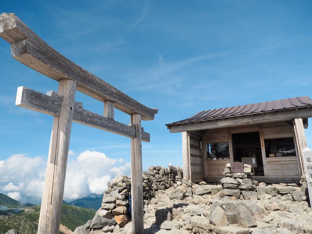
After about an hour since departing from Katanokoya Hut, we’re finally at the highest peak of Mt. Norikura, Kengamine (3,026m). Like any other mountains in Japan, it is believed that gods are everywhere in nature so it’s not a strange thing to see a Shinto shrine appear out of nowhere in a place like this.

Even though this mountain is a relatively easy one, as an adult I have to say that this is not as easy as climbing stairs at home. However, we saw many small children during the hike so I guess this shouldn’t be too hard for any healthy adult.
Drop by Mt. Fujimi and Mt. Daikoku (optional)
The descending trip is much easier and faster. If you have time and energy left, why don’t you drop by Mt. Fujimi and Mt. Daikoku before heading back to the bus terminal?
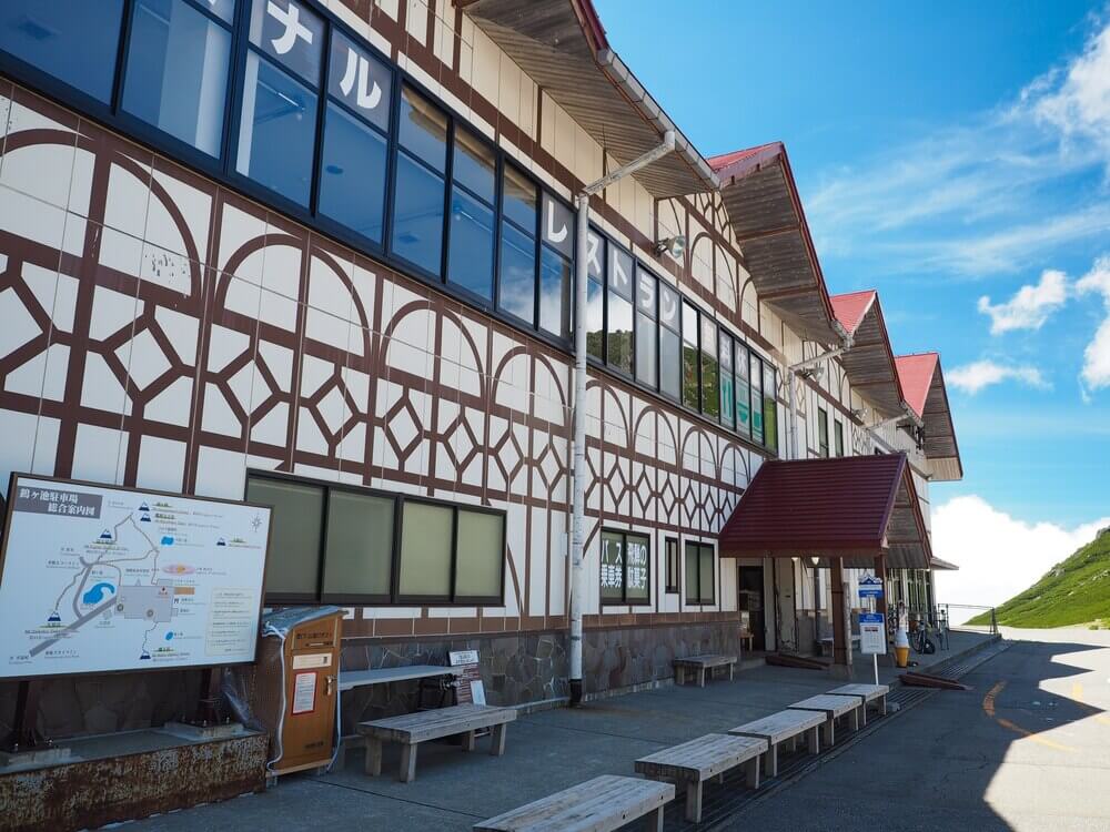
Tatamidaira area (bus terminal, restaurants, and toilets)
The Tatamidaira Bus Terminal is the highest bus terminal in Japan at an altitude of 2,702 meters. It is accessible from both Gifu and Nagano prefecture by the Skyline and the Echoline road.

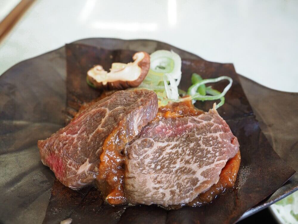
Restaurants: There are several restaurants in the area, most of which serve local specialties such as Hida beef, soba noodle, and oyaki. Most shops and restaurants close at 3:30-4:30 PM, depending on the season.
Souvenir shops: They sell not only souvenirs but also hiking clothes and equipment.
Toilets: Paid toilets (100 yen) are available on the second floor of the bus terminal while the public toilet is located near the trailhead to Mt. Maou.
Lodges: There are 3 lodges; Ginreiso (銀嶺荘), Haku-unso (乗鞍白雲荘) and Katanokoya Hut (肩の小屋).
Information center: Provides you with useful information about the trekking trails, weather and seasonal flowers. Some brochures are available in Japanese only.
Some useful Japanese words
Although the trail is easy to understand, most direction signboards are written only in Japanese. Trying to remember these kanji characters below may be useful for your hiking.
乗鞍岳 (norikuradake) Mt. Norikura (aka Mt. Kengamine)
剣が峰 (kengamine) Mt. Kengamine
富士見岳 (fujimidake) Mt. Fujimi
大黒岳 (daikokudake) Mt. Daikoku
畳平 (tatamidaira) Tatamidaira Bus Terminal
肩の小屋 (katanokoya) Katanokoya Hut
トイレ (toire) Toilet
Getting to Mt. Norikura
No private car policy
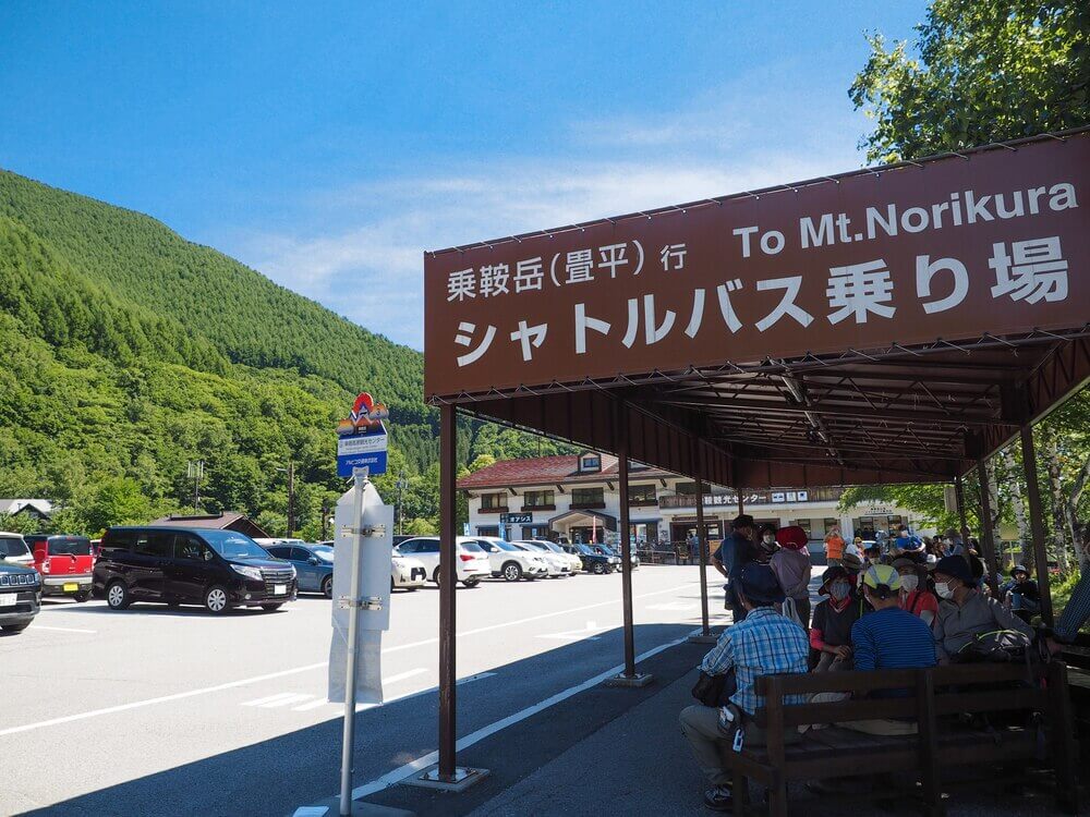
To protect the natural environment, private cars are not allowed in the mountain top area. If you are traveling by car, please park your car at the Norikura Kogen Tourist Center (Nagano) or Honoki Daira parking lot (Gifu) and use public buses to reach the summit of Mt. Norikura (Tatamidaira).
See Timetable (Norikura Kogen Tourist Center to Mt. Norikura) >
Road closed during wintertime
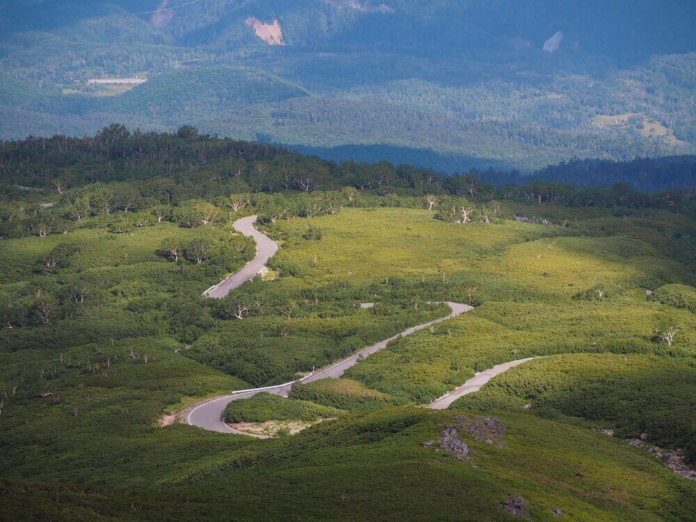
Due to heavy snowfall, the Skyline road from Honoki Daira and the Echoline road from Norikura highlands are closed during wintertime from November 1.
The Skyline road is fully opened from May 15, while the Echoline road is partially opened from around April 25 until June 30, and fully open from July 1 onward. During the partial opening, the bus will be operated as “Haruyama Bus” (aka “Snow Wall Viewing Bus”) to bring you to the Norikura Snow Walls.
Read also:
● Norikura Snow Walls: Tateyama Kurobe’s doppelganger
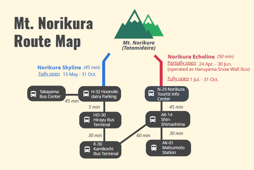
From Nagano side (Bus company: ALPICO)
Similar to how to get to Kamikochi from Matsumoto, take the Kamikochi Line train from Matsumoto station (platform no.7) and get off at Shin-Shimashima station (30 min). Then change to a bus bound for Norikura Tourist Information Center, enjoy your ride with beautiful dams and tunnels for another 45 minutes, and get off at N-29 Norikura Kogen Tourist Center. (Fare: 2,060 yen)
From Norikura Kogen Tourist Center, change again to the bus bound for Mt. Norikura (Tatamidaira). This bus goes along the Echoline road for 50 minutes and brings you to Tatamidaira, the highest bus terminal in Japan. (Fare: 1,650 yen)
See Timetable (Matsumoto to Norikura Kogen Tourist Center) >
See Timetable (Norikura Kogen Tourist Center to Mt. Norikura) >
TIPS: In the highlands area (N-29 Norikura Kogen Tourist Center), there are many things to do and see (waterfalls, ponds, cycling, and hiking routes). To avoid the long traveling time, staying overnight here is a good alternative plan.
Read also:
● Hiking through the autumn leaves in Norikura
From Gifu side (Bus company: Nouhi Bus)
From Takayama Bus Center, take a bus bound for Hirayu Onsen, get off at H-32 Honoki Daira parking (45 min). Then change to a bus bound for Tatamidaira and enjoy the view along the Skyline road for about 45 minutes before arriving at the Tatamidaira Bus Terminal. (Fare: 2,520 yen)
Recommended bus passes
Alps Crossing Ticket (Norikura-type)
This pass allows you to travel one-way from Matsumoto to Takayama or vice versa, via Mt. Norikura (Tatamidaira).
Coverage area: Matsumoto, Norikura Kogen (highlands), Mt. Norikura (Tatamidaira) and Takayama
Price: 5,000 yen
2-Day Free Passport
With this convenient pass, you can get on and off buses in the designated area as many times as you like for 2 days.
Coverage area: Matsumoto, Norikura Kogen (highlands), Mt. Norikura (Tatamidaira), Kamikochi, and Shirahone Onsen.
Price: 7,500 yen (9,000 yen for 3-day use)
4-Day Alps WIDE Free Passport
You can travel by bus freely in the designated area below for 4 days.
Coverage area: Matsumoto, Kamikochi, Norikura, Shirahone Onsen, Takayama, Shirakawa-go, Shin-Hotaka Ropeway, Gero Onsen and more
Price: 11,000 yen (13,000 yen with Shin-Hotaka Ropeway round trip tickets)
Recommended Tours to Norikura
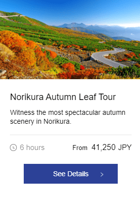
Highlights
・Easy access to one of Nagano’s most beautiful nature spots
・Admire the blazing autumn colors of Norikura’s mountainous landscape
・Stop at the best photo locations to get the perfect shot
Tour Info >